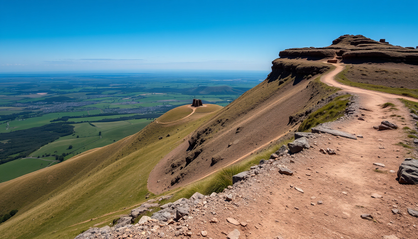
Mam Tor, often called the Shivering Mountain, is one of the most recognisable landmarks in the Peak District National Park. Rising to 517 metres above the Hope Valley, this distinctive hill draws walkers, photographers and history enthusiasts alike. Its popularity comes from a combination of stunning ridge views, rich archaeological heritage and relatively accessible walking routes that suit a range of fitness levels.
The hill sits at the western end of the Great Ridge, with the village of Castleton lying at its foot. Its name, meaning “Mother Hill” in Old English, hints at the deep history embedded in the landscape. From Bronze Age settlements to an active landslip that forced the closure of a major road, Mam Tor offers far more than a simple walk in the countryside.
This guide covers the essential information for planning a visit: the best walking routes, parking and directions, safety considerations, and the fascinating story behind the hill. Whether you are a first-time visitor or a seasoned hiker looking to explore the area, the following sections will help you prepare.
Planning Your Mam Tor Walk: Routes, Maps and Trail Info
| 🏔️ Height | 517 m (1,696 ft) – Known as Shivering Mountain |
| 📍 Location | Castleton, Peak District, Derbyshire – Near the Hope Valley |
| 🥾 Best Walk | 5.2 mile circular from Mam Tor car park – Moderate difficulty, ~2-3 hours |
| ⚠️ Safety Note | Check weather before you go – Exposed summit, wind and fog risk |
- Mam Tor is one of the most visited landmarks in the Peak District, ideal for beginner to intermediate hikers.
- The ‘Shivering Mountain’ nickname refers to its active landslip, making parts of the area unstable.
- Best visited on a clear day for panoramic views of Kinder Scout, Edale, and the Hope Valley.
- Free parking at Mam Tor car park fills quickly by 9 AM on weekends.
- The circular walk via the Great Ridge is the most recommended route for first-time visitors.
| Attribute | Detail |
|---|---|
| Name origin | Old English: ‘Mame Tor’ → Mother Hill |
| First recorded ascent | Bronze Age settlement on summit |
| Landslip event | Major A625 road closure in 1977; ongoing erosion |
| Designation | Site of Special Scientific Interest (SSSI) |
| Nearest town | Castleton (1.5 miles) |
| Car park postcode | S33 8WA (approx) |
| Toilets | At Mam Tor car park (seasonal) |
Mam Tor Parking and Directions: Where to Park and How to Get There
Mam Tor Car Park: Location, Cost and Postcode
The main trailhead is the Mam Tor car park (also called Mam Nick Car Park), operated by the National Trust. The postcode is roughly S33 8WA. Parking is pay-and-display, and one guide states £4.50 for up to 4 hours. Multiple sources confirm this is the standard starting point for the classic circular walk. The car park can fill quickly on weekends, with one account noting it is often full by 9 AM.
Arriving before 9 AM on weekends improves your chances of finding a space. The car park is free, but limited in size.
Getting to Mam Tor by Car or Public Transport
By car, Mam Tor is easily reached from the A625 via the village of Castleton. The route is well signposted from the Hope Valley. For those using public transport, the nearest train station is Edale, about 2.5 miles away. Several guides mention starting from Edale Train Station or Edale Car Park for longer routes. Bus services from Sheffield and Castleton also serve the area, though the frequency is limited.
Facilities at the Car Park
Opinions on facilities vary. Some sources state there are no toilets at Mam Nick Car Park, while others mention seasonal toilets. The most reliable approach is to plan ahead and use facilities in Castleton before starting. There are no shops or toilets on the walking route itself.
Mam Tor Weather and Safety: Is It Dangerous?
Understanding the Ridge Exposure
The walk is exposed along the ridge, and conditions can change rapidly. Several guides emphasise that the route is best attempted with attention to wind, rain, and visibility. The summit and ridge are particularly vulnerable to sudden fog and strong gusts, which can disorient walkers. Check the Met Office weather forecast for the Peak District before setting out.
The ridge offers no shelter. In high winds, rain, or fog, the walk becomes significantly more challenging. Consider postponing if poor weather is forecast.
The Landslip and the Broken Road
The “Broken Road” is an abandoned section of the A625 caused by a major landslide. The landslip is one of the most active in Britain, moving a few centimetres per year according to the British Geological Survey. The road was permanently closed in 1977 and is now incorporated into the walking route. Caution is advised near the landslide area, as the ground can be unstable.
What to Wear and Bring
Because the route includes stepped climbs, ridge walking, and sometimes muddy or uneven sections, a moderate fitness level is commonly recommended. Sturdy waterproof boots, a windproof jacket, and layers are essential. The Women’s jacket guide for hiking offers suggestions for appropriate outerwear. Carry water, snacks, a map or GPS, and a fully charged phone.
The Story of Mam Tor: History, Meaning and Geography
What Does Mam Tor Mean?
The name Mam Tor derives from Old English “Mame Tor,” meaning “Mother Hill.” This likely refers to its role as a prominent landmark visible from many surrounding valleys. The nickname “Shivering Mountain” comes from the debris shed by the active landslip on its eastern flank.
The Height and Geology
Mam Tor stands at 517 metres (1,696 feet). Its geology consists of interbedded shale and gritstone, which makes it prone to landslips. The hill is part of the Dark Peak area and is designated a Site of Special Scientific Interest (SSSI) due to its geological features.
The shales and sandstones of Mam Tor are particularly susceptible to erosion, which has created the distinctive landslip terrain visible from the ridge.
Bronze Age Hill Fort and Later History
The summit of Mam Tor bears evidence of a Bronze Age hill fort, with a double rampart still visible in places. The settlement dates to around 1000 BC. The hill was later used as a beacon site during the medieval period. The first recorded use of the name “Mam Tor” in print appears in 1819. Quarrying activity at the base occurred in the early 1900s. The major landslip of 1977 led to the permanent closure of the A625 road below. The Wikipedia entry for Mam Tor provides a detailed overview of its history.
A Timeline of Mam Tor’s History: From Bronze Age to Landslip
- Bronze Age (c. 1000 BC): Hill fort settlement on Mam Tor summit.
- Medieval period: Used as a beacon hill and route marker.
- 1819: First recorded use of name ‘Mam Tor’ in print.
- 1900s: Quarrying activity at base; landslip becomes notable.
- 1977: Major landslip forces permanent closure of the A625 road below.
- 2000s: Became part of the National Trust’s High Peak estate.
- 2020s: Ongoing landslip monitoring; popular walking destination.
What Do We Know and What Remains Uncertain About Mam Tor?
| Established Information | Information That Remains Unclear |
|---|---|
| Mam Tor is 517 m (1,696 ft) high. | Future landslip activity is unpredictable; some paths may shift. |
| There is a well-known landslip beneath the eastern face. | Seasonal weather can cause sudden visibility loss. |
| The A625 road is permanently closed due to the landslip. | The exact date of the Bronze Age fort’s construction is unknown. |
| Free parking is available at the Mam Tor car park (S33 8WA). | Whether the car park toilets are open year-round is not consistently reported. |
What Makes Mam Tor a Unique Peak District Destination?
Mam Tor sits at the western end of the Great Ridge, a major geological feature of the Dark Peak area. Its shale and gritstone layers make it prone to landslips, which have shaped both the landscape and local folklore. The hill’s popularity stems from its accessibility via a short drive from Sheffield and Manchester, combined with stunning ridge walks that suit families and seasoned hikers alike.
In a regional context, Mam Tor competes with Olympus Mountain hiking guide for visitor attention but offers a shorter, more family-friendly route. The combination of panoramic views, historical interest, and dramatic geology makes it a standout destination within the Peak District.
What Do Experts Say About Mam Tor?
Mam Tor is the mother hill, the heart of the Peak District landscape.
National Trust Kinder Edale and the High Peak (www.nationaltrust.org.uk)
The landslip at Mam Tor is one of the most active in Britain, moving a few centimetres per year.
British Geological Survey (cited via Wikipedia)
Final Thoughts on Visiting Mam Tor
Mam Tor offers a rewarding walking experience that combines natural beauty, accessible trails, and a rich history. Whether you choose the short summit walk, the classic circular route, or a longer trek along the Great Ridge, preparation is key. Check the weather, arrive early for parking, and wear appropriate footwear. The National Trust circular walk page provides official route details, while the Visit Peak District page offers additional visitor information.
Frequently Asked Questions
What does Mam Tor mean?
Mam Tor means ‘Mother Hill’ in Old English, from ‘Mame Tor’.
How long does it take to walk Mam Tor circular?
The classic circular walk is about 5.2 miles and takes 2-3 hours at a steady pace.
Is there a waterfall near Mam Tor?
There is no waterfall on Mam Tor itself, but nearby Kinder Downfall and Lathkill Dale are within 30 minutes drive.
Can I walk Mam Tor with a dog?
Yes, but dogs must be on leads near livestock (sheep graze the area) and under control on the steep ridge.
Is Mam Tor suitable for children?
Yes, the circular route is suitable for children with good fitness. Avoid in high winds or fog.
Are there toilets at Mam Tor car park?
The car park has seasonal toilets, but some sources report none. It is best to use facilities in Castleton before heading out.
Is the Mam Tor walk free?
Parking at the Mam Tor car park is free, but the pay-and-display system may apply. The walk itself has no entry fee.
What is the best time of year to visit Mam Tor?
Spring and autumn offer mild weather and clear views. Winter can be icy and requires caution. Summer is popular but busy.
How do I get to Mam Tor from Sheffield?
By car, take the A625 via Hathersage and Hope towards Castleton. Public transport: bus services run from Sheffield to Castleton, then a walk or short taxi to the car park.
Is Mam Tor harder than Kinder Scout?
Mam Tor is generally considered easier and shorter than Kinder Scout. Kinder Scout involves a longer, more strenuous hike with more challenging terrain.